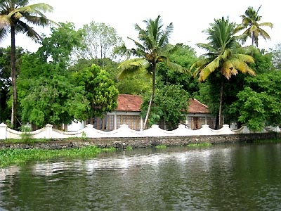
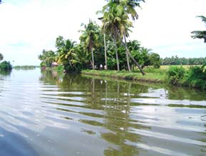
 Kuttanad lies sandwiched between the sea and the hills. Kuttanad is an amazing labyrinth of shimmering waterways composed of lakes, canals, rivers and rivulets. Lined with dense tropical greenery, it offers a glimpse into rural Kerala life-styles. The view changes from narrow canals and dense vegetation to open vistas and dazzling green paddy fields. Homes, farms, churches, mosques and temples can be seen among the trees. And if you are lucky you might catch the blue flash of a kingfisher or the green of a parakeet. Endless tranquility is yours for the taking here.
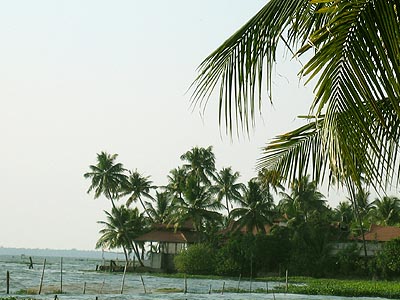
Kuttanad Backwaters called the rice bowl of Kerala, because of her wealth of paddy crops is at the very heart of the backwaters. The scenic countryside of Kuttanad Backwaters with its shimmering waterways also has a rich crop of bananas.
Kuttanadu in Kerala, India is the lowest region of India, with 500 square kilometres of the region below sea level. Its elevation ranges from 0.6 m above to 2.2 metres below sea level. Most of the area is covered with water throughout the year. Kuttanadu is one of the few places in the world where farming is carried out below sea level. The region has a population of 1.8 million and comes under the Alappuzha district.
Four major Kerala rivers, the Pampa, Meenachil, the Achankovil and the Manimala flow into Kuttanadu. Despite being surrounded by water, there are acute potable water shortages, with water supplied only twice a week.
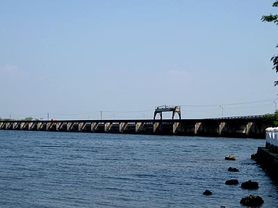
Thanneermukkam Bund
The major occupation in Kuttanadu is farming. Rice is the important agricultural product, giving Kuttanadu the monicker of "The Rice Bowl of Kerala". Three crops are grown every year now instead of the traditional two per year. Large farming areas near Vembanad Lake (Vembanadu Kayal) were actually reclaimed from the lake. The king decreed that whoever retains land can own it leading massive redemption of land from the lake. As the farming in the area increased farmers felt themselves constrained by the two cycles a year for rice cultivation. The reason for which is the availability of potable water in Kuttanadu. During the monsoon seasons, the water from the mountains flow through the rivers to the sea, bringing potable water to Kuttanadu. But during summer, due to the low level of the region, seawater enters Kuttanadu and makes the salt content of the water high making it unpotable. During 1968, government of India proposed a project, in which a bundh (Dam) will be made across the river so that seawater will not be allowed to come inside Kuttanad during summer, allowing farmers to cultivate and extra cycle per year. The project was planned in three phases, the south side, the north side and another phase to join the two sections. The project was delayed and by the time the first two phases were complete the entire money allotted for the project ran out and left the final phase in limbo. The farmers who were expecting lots of financial benefits after the completion of the project decided to take matters into their own hands and one night in 1972, a large group of farmers filled the gap between the north and the south side with earth. To this day, the earth embankment between the two sections of the bundh remains.
Eventhough the bund has improved the quality of life of the farmers, the bund is alleged to have caused severe environmental problems. The backwaters which were abundant with fish and part of the staple food of the people of the region require a small amount of salt water for their breeding. The bund has caused deterioration of the catch of fish in the region and the fishermen are opposed to the bund as of 2005. The bund has also disrupted the harmony of the sea with the backwaters and has caused problems not foreseen before the bundh like the omniprescence of the water weeds. Earlier the salt water tends to cleanse the backwaters but this does not happen any more leading to the pollution of the backwaters and the entire land nearby.